
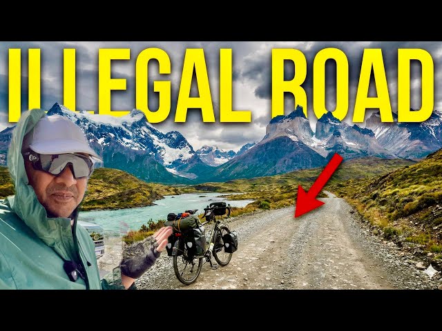
This Road Should Be ILLEGAL || Carretera Austral Must Sees Ep.23
Many of my friends ask me, “What do you gain from cycling?”
I say, you get the chance to truly see nature. Because views like this – I don’t want to miss them.
From here, the loops will start, like mountain hairpin bends – sometimes sunshine, sometimes shade.
Namaskar, Salaam, Sat Sri Akal, Ram Ram to everyone. I’m back again from Chile’s Carretera Austral. About 400 km of the route is still left; I’ve already covered 800 km. In the last video, you saw that I stayed at a campsite. Today, I’m leaving from that campsite.
Here is Dhano standing ready. You can see some cyclists here. At the moment, there are about 12–13 cyclists staying at this campsite. All of them are going south, while I’m heading north – so I’m riding in the opposite direction. Because of that, I meet many cyclists during the day. Sometimes I meet 50 cyclists in a single day. Most of them are from Europe, especially Germany. Germans travel a lot on this route.
I’ve met many Germans in other places too. Earlier, I met many of them in Namibia. Namibia used to be a German colony, and it is a very beautiful country to visit. You can see the Kalahari Desert there. Africa is quite close to India, so you can travel there easily.
Yesterday the temperature was around 30–32°C. But today it’s cloudy, which is in our favour. However, there’s one problem – the wind. It’s only 8:30 in the morning and the wind has already become strong. It will remain a headwind throughout the day. So today we’ll fight the wind and enjoy the ride. I only have to cover 60 km. Even if it takes 12 hours, that’s more than enough because we also have to cross a pass similar to Rohtang Pass.
These people you see have hired their bicycles from Puerto Montt. They rent them there and drop them at the final point where the 1,200 km road ends. Their luggage is transferred by the company to the last point. You can also rent a bicycle here if you don’t bring your own. Anyone can complete this 1,200 km journey. For those living in the US or Canada, it’s even closer. If you want to test your stamina and witness beauty, you must do this route at least once – especially in November. In November it’s even more beautiful, with the mountains behind covered in snow.
That was our campsite. Now I’m leaving. The wind has picked up strongly. No problem – let’s keep going with full energy.
We are currently at 216 metres above sea level. We have to climb up to about 1,300 metres. It may look flat from here, but it’s actually zigzag. Total elevation gain is around 1,300 metres over 60 km. The first 25–30 km are fine, then gravel starts.
I’ve just covered 4–5 km, and look – sunshine on one side, rain on the other. That’s nature: sometimes sun, sometimes shade.
Here’s a river. They’ve made a small resting area above it as a viewpoint because it often rains. From here, you can see the entire valley and snow-covered mountains in front. The river spreads across many square kilometres. Pumas live in this region, and a particular species of deer found only here is now close to extinction. You can scan a code here to read full details.
It’s raining lightly. There’s a glacier above. Sitting in the lap of the glacier, I’m eating the rajma and chapati I made yesterday.
Look at the “queen of the road” – a Scorpio car. There’s another one behind. I’ve never seen so many Scorpios outside India.
Normally, I don’t eat this early, but it’s 11:00 am and I’m already hungry. The weather is cool today. Yesterday it was very hot and rushed; today it’s cold and pleasant.
This is where the Lago Verde area ends and a new region begins. Whenever regions change here, there’s a boundary sign like between cities.
Look at this – the mountain is above us, the river below, and a bridge connecting the two. We’ve left the clouds behind. Ahead, we’ll reach a point from where we can properly see the glacier at around 700–800 metres elevation.
There’s a road turning left towards a famous lake about 30–32 km away. But we have to go straight and climb continuously for the next 8 km. The elevation here is around 590 metres and rising.
Look at that caravan – a woman driving it alone. Respect!
The road is zigzag, and there’s a 2 km steep climb. I’ll have to walk about 6 km, so in total around 8 km walking. Why walk? Because if the gradient is 6%, you can ride. But above that, especially near 8%, continuous riding becomes very difficult.
Biker gangs are common here too. At dangerous bends, they’ve painted the centre of the road red so vehicles don’t drift across and cause accidents. Small things, but important lessons.
Many friends ask me, “What do you gain from cycling?”
I say, you gain the opportunity to see nature closely. Your perspective changes – about travel and about life. Look at the view behind me. A car or motorbike rider may never truly see this the way I can on a cycle.
During this cycling journey, I see small details that others usually miss. Sometimes I cannot even describe in words how incredible this Earth is. It’s so beautiful, so precious. You just need to observe it closely. The day you truly connect with it, when your heart and eyes get absorbed in it, you’ll think – wow, this is nature.
While climbing, look at the glacier ahead. Snow on this side too. See how the river flows below. I feel like flying the drone here. Should I try? I hope it doesn’t get caught in the wind. But those who try never lose.
So friends, how did you like the drone footage? If you liked it, press the like button and leave a comment. I’ve seen many views, but nothing quite like this.
Just look — if you go straight up there, the entire glacier is above. A flowing glacier is coming down this side. And look at the clouds above, moving so fast. Oh my goodness, look at this glacier! Water is coming down from the top like a waterfall, and that water is flowing here. I feel like filling my bottle because I’ve run out of water. Now we’ll drink glacier water. Oh wow, it’s absolutely chilled — ice cold, like pure snow!
Today the temperature is 20°C, yet there’s snow all around. Even with that, it’s still 20 degrees. The glaciers are melting very fast. Normally, this area does not have such temperatures, especially these days. Someone just told me that this local glacier has moved back almost 200 metres — it has melted that much.
After 2 km, we’ll reach gravel. From there, the downhill will begin. Only 2.6 km of climbing left.
Our friend Raunak from Monkey Magic has prepared this vehicle. How does it look? Best wishes to him — travel safely!
There are trekking routes from here. Some people are going trekking. And now we’ll start going downhill from here. Come on, let’s pull through.
We still have to ride 35 km today, but we have enough time.
Look at that glacier in front — it’s giving views like no other!
Hi! Where are you from, guys?
“I am from India.”
“And you?”
“Argentina.”
“Germany.”
About 80% of travellers here are from Germany. Every second cyclist seems to be German!
Someone advised me: “Keep more weight on the front wheel.”
Okay!
I just met four more cyclists. From here, “ripio” starts — that’s what they call gravel roads here. When they say, “It’s just a little,” don’t believe it. Gravel is gravel! For us Indians, gravel means proper rough roads. Money is money, and ripio is ripio!
Tick-tick-tick-tick… the sound of stones hitting the tyres.
Welcome to Chile! Honestly, the road shouldn’t be this bad. Fine, make it unpaved — but at least remove the potholes and big stones! Anyway, I’ll manage. I’ll see you ahead. Otherwise, you’ll get bored listening to me talk non-stop. I just keep speaking whatever comes to my mind.
This road is seriously rough. Now the loops will start, like mountain hairpin bends. But there’s a lot of plantation, so nothing much is visible from the top. Otherwise, I would have flown the drone.
Oh ho ho ho… my hands are going to hurt because I have to keep pressing the brakes constantly while descending.
Done just 3 km. What? Only 3 km!
A girl was troubled by flies. She said, “I hate these flies!” I told her to use spray. She said she didn’t have any. Argentinians are really tough — whether male or female.
This reminds me of the old road to Neelkanth in India. Years ago, it used to be like this before they made it proper.
Please don’t raise so much dust, brother! Drive slowly!
Finally, I’ve reached the bottom. Look how many loops I came through — 14 rounds from one side to the other. From here, it will be a bit flat, but still gravel. The condition is terrible. Dust is flying everywhere. I’m covering my face and just riding on — rattling all the way.
We’ve reached near the sea. Well, not exactly the open sea — it’s more like a fjord, where the sea enters deep into the land. There are still 5–6 km of gravel left. Some cyclists from the US told me that too. I’m just praying — somehow let me reach!
I think only 1 km of gravel is left. Come on, Dhano (my cycle), don’t fall now! You’ve already done 500–600 km on gravel. Don’t fall at the end!
There it is — proper road! Thank God! The whole rhythm of the bicycle changes. It was rattling like old bones before.
There’s a camping site here, and a glacier is visible in front. I’m thinking of stopping here tonight and flying the drone. The glacier looks beautiful.
The place is called Refugio Baños (meaning toilets). Camping cost me around ₹1,700. I bought something to eat — a sandwich — and paid around ₹1,000 more. So around ₹1,500–₹2,000 in total today. There’s a Wi-Fi zone here; let’s try it. This is the bathroom, and they’ve even put a roof over the camping area. That’s good.
There’s a kitchen too — I think we can use it. The restaurant here is closed, but they have a food truck instead. The people were helpful. I had run out of cash, so I paid by card.
The glacier you see in front looks small from here, but it’s actually quite big. It’s 5–6 km away. I’ll try flying the drone towards it — if the wind allows.
From here, Chaitén city is about 220 km away. I’ll reach there in two or three days, depending on the climbs. From Chaitén, I’ll need to take a ferry for the next 150 km. There are two options: either go by road with three small ferry crossings, or take one direct ferry from Chaitén to Puerto Montt.
Another cyclist just arrived.
“Are you okay?”
“Where are you from?”
“I’m from India.”
“Great!”
There’s slightly better Wi-Fi speed here, so I’ll camp here tonight. They’ve put gravel on the ground inside, but I’ll pitch my tent outside because it’s more comfortable. It won’t rain tonight.
It’s 7:00 pm, so I’ll fly the drone once more and enjoy the glacier view.
My tent is ready. Sunset is about to happen. It’s around 8:30 pm. I’ll take a shower now. Some people from Brazil are camping next to me, and they gave me access to their Starlink because the regular Wi-Fi wasn’t working well. That’s the advantage of travelling with Starlink — you get internet anywhere.
I’ll clean my gear as well. Everything is dusty. Even my face feels like pigeons have been flying over it!
I only have porridge left to eat because I haven’t been to a proper supermarket in four days. Small shops here are expensive, and I’ve run out of cash. I started with $1,000 just for food, and it’s already gone in one month. The Patagonia region is very expensive. But for people living in the US and Canada, this place is a must-visit at least once in your lifetime.
We’ve set up our tent right in front of the glacier. Tonight, I’m thinking of doing some stargazing. Let’s see if it works.
The weather is amazing. Look at that glacier. I’ve made porridge for dinner. I’m sitting outside the camping kitchen because I don’t want to miss this view. This is natural colour — no colour correction at all.
We’ll have dinner now and end the day here.
See you tomorrow with a new video.
Until then, stay happy, stay busy, stay cheerful, stay healthy.
Jai Hind!
And you’ll say — Jai Hind, Jai Bharat!