
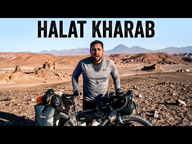
Beech Registan Mein Halat Kharab 😭 I Collapsed in Atacama Desert 🇨🇱 Ep.38
Greetings, hello, Sat Sri Akal, Ram Ram to everyone, once again welcome to Antofagasta, I reached here last night and as soon as I arrived I took a room and went straight to sleep, there was a pizza shop nearby so I bought a pizza, …
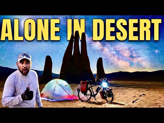
Middle of Nowhere ⛺ Camping Next to Giant Hand ATACAMA DESERT Ep.37
Situations have changed, emotions have changed.Welcome to this Mars-like land on Earth. And today’s camping is also going to be in a very special place. Friends, welcome to the Pan-American Highway. Good morning, friends! I have woken up. This was my room. I only used …
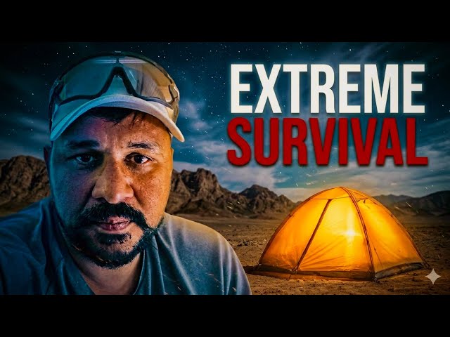
Indian Alone in the Atacama Desert… SCARIEST Night ⛺ Ep. 36
“What’s up from India, India?”No ghosts came, my friend. Only one fox came at night. Namaskar, Salaam, Sat Sri Akal, Ram-Ram ji.Once again, welcome to my channel, to the Pole to Pole journey, the Antarctica to Alaska expedition, the world bicycle journey. I don’t even …
Search
Categories
Tags
- COLOMBIA 🇨🇴 ke KHATARNAK aur KHUBSURAT Roads pe Akela INDIAN 🇮🇳 Ep.58Hello, Namaskar, Salaam, Sat Sri Akal, and Ram Ram Ji! Once again, welcome back to my channel. Right now, I’m in Bogotá, the capital city of Colombia, and today we’re starting our ride from here. It’s already 10:00 AM. I had planned to start early in the morning, but it was raining, so I couldn’t leave. It’s still drizzling a little, but now I have no choice—I need to get moving. The thing is, it can rain here at any time, on any day. So, before leaving the city, I’ll stop at an Indian restaurant, pack some food, and then continue my journey. Today, I’ll probably ride around 50–60 km. The first 100 km is mostly downhill, and after that, the climb begins. Right now, we’re at an altitude of 2,650 metres above sea level. Even if I leave around 12 or 1 PM, riding at an average speed of 15 km/h, I can comfortably cover around 90 km in 5–6 hours. So, let’s get going. My bicycle, Dhanno, is all set. I cleaned it thoroughly and got everything ready. I stayed at this hotel for four or five days. It was a bit expensive, but overall, it was a nice place. Come on, Dhanno, let’s go! I’ll keep this flag on for a while, although it’s broken from here. Once I get into the local areas, I’ll remove it. But inside the city, I’ll keep it on. I’m waiting at a red light right now. Just look at this house! The artwork and mural painted on it are absolutely beautiful. We’re heading towards an Indian restaurant nearby. There are supermarkets like D1, OXXO, and another major chain here. Slowly moving ahead… Here we are! There are three or four Indian restaurants and also a few Pakistani restaurants in this area. This is Ajay Bhai. They even keep the restaurant gate locked from the inside for safety. “Namaste, brother!” “Namaste! How are you?” Preparations are going on inside. Alright, I’ve left the Indian restaurant now. I had my meal and also packed two parathas, which will be enough for tonight’s dinner. Now let’s continue. The underpass here is really well built. If you want to reach the city centre, you just take this route. I’ve now left the city behind. There are so many motorcycles here—Honda, Hero, Bajaj, and TVS are the most common brands. Just like back home, motorcycles are everywhere. Look at their national flag. There’s a football match today, and people here are absolutely crazy about football. I decided not to take the highway. Instead, I’m riding through the city streets. Bogotá is a well-planned city. The streets don’t have names—they’re identified by numbers. Honestly, riding through cities has its own charm. These green buses you see are electric buses, while the blue ones are regular buses. Public transport here is excellent. There are buses everywhere. Bogotá is the largest city in Colombia. The city I’m heading towards is the country’s second-largest city. What’s this? “Tejas.” And look—there’s a Honda showroom. Hero also has many dealerships here. Looks like it’s going to rain again. It had only just stopped. The roads are quite rough in places. There’s another red light ahead. That’s a Ford truck. And here’s the toll plaza just outside the city. They’ve done one good thing—they’ve made a separate lane for motorcycles. I’ve already ridden about 20–25 km outside Bogotá, but the traffic on the opposite side is still heavily congested. The drizzle has started again. We’re approaching a place called Madrid. Of course, Madrid is also the capital of Spain, and across Latin America, you’ll often find towns and cities named after famous places from other countries. And here we are—Madrid. Wow! There’s even a cycling lane, although it’s full of junk. This is Hospital Maria. This appears to be the city centre. I’m not even sure whether this is Madrid or the neighbouring town because both cities are connected so closely. I’m riding at a great pace now. The weather is perfect because there isn’t much sunlight. Oops… it’s raining again! So I’ve stopped for a cappuccino. I’ll have a coffee before continuing. The coffee machine is acting up, so they asked me to wait for five minutes. By the way, when I stayed in Lima, then Quito, and now here, I was lucky enough to find Indian restaurants everywhere. I’d eat proper Indian food there and also pack an extra meal for later. Thanks to all that delicious Indian food, I’ve gained back the weight I lost while cycling through Bolivia. Now I’m fit again—but honestly, I need to lose some weight because I get slightly out of breath. Right now I’m at an altitude of around 2,580 metres, and I can already feel it. Imagine what it would be like at 3,700 or 3,800 metres. I’ll leave once the rain eases. These public buses are quite aggressive on the roads. Coffee’s done, and the rain has become lighter. Let’s continue and see how far we can reach today. This shopping centre reminds me so much of India. There’s just one major difference—people hardly use their horns here. Otherwise, it’s just like back home. Vehicles keep squeezing through traffic, there are roadside shops, roadside parking—everything feels familiar. Let’s keep moving. Cycling and motorbikes are extremely popular here. Interestingly, you’ll see more women riding bicycles and motorcycles than men. Wow! That’s a new-style motorcycle. Come on, Dhanno! The sun is out, yet it’s still raining. Back home, we say, “The ghosts are getting married,” whenever it’s sunny and raining at the same time. Even this small town has a Domino’s Pizza. And once again, the rain has started. Today’s destination is a place called Villeta. It’s about 60 km away. It’s already 2:00 PM, but I still have about four hours of daylight left. If the rain doesn’t become too heavy, I’ll easily make it because after another 10–20 km, the downhill section begins, and then my average speed should increase […]
- Colombia 🇨🇴 Ki Rangeen Rajdhani — Bogota Mein Ek Din! | Ep.57Oh my goodness! The clouds rolled in so quickly. Just look how everything disappeared into the mist. This area has witnessed the deaths of many people in the past. On the other side of these mountains, the Amazon rainforest begins. The ancient tribes who have lived here for generations are still known for their fascination with gold. Just look at how beautiful Bogotá looks from up here. Hello, Namaskar, Salaam, Sat Sri Akal and Ram Ram to everyone! Once again, welcome back to my YouTube channel. Right now, I’m in Bogotá, the capital city of Colombia. In the previous video, you saw how I finally made it here after quite a difficult journey. Behind me is the hotel where I’m staying. I’m paying around 97,000 Colombian Pesos per night, which works out to roughly US$30, or about ₹3,000 per day. Today is my third day here. Yesterday, I visited the Indian Embassy. One thing you’ll constantly hear here is the noise from these birds behind me. Security is a major issue in Bogotá. Look at that house behind me—you can see security fencing with electric wires on top. Almost every house has similar protection. Even at my hotel, whenever I leave my room, the staff unlock the main gate, let me out, and immediately lock it again. Everything is electronically secured. Yesterday, I visited the Indian Embassy, and honestly, I’ve never seen such tight security at any Indian Embassy anywhere in the world. Another thing about Bogotá—it rains almost every day. For the last two or three days, it’s been drizzling continuously. The city sits at an altitude of around 2,625–2,700 metres above sea level, so we’re already quite high. Today we’re going on a city tour, so make sure you watch until the end of the video. I also noticed that only about 20% of the people watching my channel have subscribed. The rest of you haven’t subscribed yet. Subscribing doesn’t cost anything, but of course, it’s entirely your choice. I don’t usually ask, but today I felt like having a heart-to-heart conversation with you all. Anyway, let’s begin exploring the city. Joining me today is my friend. “How are you, brother?” “I’m doing well. How about you?” “Everything’s good.” He’s from Pakistan. Our mutual friend, Manish Bhai, introduced us, and since he lives nearby, he helped me find this hotel. My Uber has arrived. Uber works here just like it does in India. I’ll sit in the front. It’s a small car. You can see the mountains right in front of us. That’s where we’re heading first. It’s already started raining. If you’re travelling in Bogotá and want to stay safe, I’d strongly recommend using Uber to get around. Try to avoid carrying luggage on local buses because incidents like pickpocketing and snatching do happen. Ultimately, your safety is in your own hands. As they say, “Once bitten, twice shy.” Since I was recently robbed, I’m naturally much more cautious. That’s also why I chose to travel by bus from the border to Bogotá. Our driver has dropped us off. Since it’s raining, we’re now heading towards the ticket office. Here’s the ticket price. It’s quite expensive. From Monday to Saturday, a round-trip ticket costs 35,000 Colombian Pesos, which is around US$10 or roughly ₹1,000. Anyway, we’ve bought two tickets—one for my friend and one for me. Now it’s time to go up. This is the cable car. It was built here in 1950 by a Swiss company. It’ll take us around 500 metres higher. You can already feel the thinner air up here. I’m slightly out of breath. Honestly, I’m also a little nervous. The cable car doesn’t leave unless it’s completely full. As you already know, I’m afraid of heights. There we go—it’s moving! Just look at the incredible view of the entire city. The journey from the bottom to the top takes about five minutes. I’ve chosen to stand in the middle. We’ve arrived! The wind up here is incredibly strong. There’s also a beautiful church here. Wow! The view is absolutely breathtaking. Only the strong wind and rain are making things a little difficult. There’s a statue over there. “What is this place called?” “Guadalupe.” “Oh, Guadalupe.” It’s even higher than where we are now. A road also leads all the way up there. We’re now standing at around 3,150 metres above sea level. Let’s walk over there. This church dates back to the 1700s. It was later renovated. Just imagine how difficult it must have been to carry all the construction materials to such a height back then. They’ve built something truly remarkable. There’s also a café and a small market nearby. Bogotá looks absolutely magnificent from here. The city lies right in the middle of the Andes Mountains. It’s surrounded by mountains on every side. We’re not planning to buy anything here. They’ve got all kinds of local souvenirs. Now we’ve reached the other side. These mule handlers transport supplies up and down the mountain. Look at that mule! It’s carrying so many bottles of beer. Just look at this tree. It’s even more beautiful than the flowers around it. We’ve explored this area now. Let’s head back and I’ll show you one more panoramic view before we continue into the city centre. There’s one special attraction in Bogotá that I’ll show you towards the end of the video. The weather has cleared slightly. Earlier, it was raining over there. That’s mountain weather for you—it changes constantly. Let’s head back towards the church. After that, we’ll continue. What could anyone possibly steal from a church? Yet even here, security is a major concern. This church was originally completed around 1730. The Spanish arrived in this region during the 1500s. Although Bogotá already existed, it was the Spanish who developed the city on a much larger scale. There’s Bogotá’s international airport. The entire city lies inside this vast valley, surrounded by the Andes Mountains. The mountains on this side are the eastern […]
- INDIA 🇮🇳 To COLOMBIA 🇨🇴 on Bicycle 🚴 Finally I Reached Colombia Ep.56Welcome to Cycle Baba’s world journey across 136 countries. This journey is not without danger. 7 lakh…“Yes, 23… cuatro… cinco…” In this video, I’ll take you all the way to Bogotá, Colombia. Hello, Namaskar, Salaam, Sat Sri Akal and Ram Ram to everyone! Once again, welcome back to my channel. Right now, I’m in Tulcán, the last city of Ecuador, which is my 135th country. I arrived at this hotel last night and stayed here. It’s called Park Hotel. Today, I’ll be crossing the international border. The border is only about 10 kilometres from here. I chose this hotel because it’s close to the Tulcán bus terminal. There are serious safety concerns in this area. You’ll notice them yourself as we continue the journey. Dhanno (my bicycle) is ready to cross the border, so let’s get going. I’ll keep talking as we ride. Oh wow! I just spotted the first car I ever owned in my life. I’m now riding through the city. The roads here are constantly going uphill and downhill. I had expected northern Ecuador near Colombia to be fairly flat, but it’s been nothing but steep climbs and descents. This is the city’s Plaza de Armas, with the church on one side and the public square in front. That’s what they call the Plaza de Armas. Here is the municipal office of Tulcán. The security presence here is incredible. Even early in the morning, there are police officers everywhere. Here’s another park. The border is still about 6–7 kilometres away. Look at this modern church. There’s also a sports complex here. From this point, you can hire transport directly to the border. All these vehicles are waiting to take passengers there. Tulcán is quite a large city, and it even has an international airport. It’s roughly 150–200 kilometres from Quito. Yesterday I arrived very late, so today I’m heading towards the border as early as possible. As you know, I never like crossing borders in the evening, especially dangerous ones like this. You can really feel the tension here. Look around—even in the narrow streets, police officers are patrolling with firearms. They all have revolvers on their belts. The first city in Colombia is said to be even more dangerous. The markets haven’t opened yet. I left at around 8:00 a.m., so I should reach the border between 8:00 and 9:00 a.m. I want to cross into Colombia as quickly as possible and then decide my next move once I’m there. I don’t know much about Colombia yet. There are significant safety concerns. Someone has decorated their home beautifully. There are also plenty of private hospitals, pharmacies and orthopaedic clinics here. Colombia recently had elections, and crime often increases during election periods. The elections ended the day before yesterday, so now it’s time for me to enter Colombia. Once I’m there, I’ll see how safe it really is and make decisions accordingly. All the advice I’ve received has come from the Indian Embassy and other experienced travellers. Everyone has suggested that I take a bus instead of cycling. The reason is that only one international border crossing between Ecuador and Colombia is currently open, and the area where I’m entering isn’t considered very safe. As they say, “Once bitten, twice shy.” Since I was recently robbed, I’m naturally more cautious now. I think it’s wiser to cross this unsafe stretch by bus. Once I reach Bogotá, Colombia’s capital, I’ll reassess the situation. In this video, I’ll take you all the way to Bogotá. Here’s a petrol station. I’m stopping for a coffee. It costs $2.50. Even leaving my bicycle outside while I go in for a coffee makes me nervous. I keep worrying that someone might steal it. People seem to stare at your belongings in a strange way here. This is the first time I’ve genuinely felt that. Usually, people look at me with curiosity in a positive way, but here the attention feels different. Anyway, that’s not my concern. I’ll enjoy my coffee and continue. There’s a bakery here. I bought some bread and two enormous biscuits. The two biscuits cost $1. Honestly, I’ve never seen biscuits this big in my life. I’ll pack them up and carry on. Look over there—vehicles belonging to the United Nations are parked nearby, and several police vehicles are stationed here as well. We’re now riding alongside a river, which eventually becomes the international border. We’re getting very close now—only about 3–4 kilometres remain. These people are coming from the border while we’re heading towards it. Entry isn’t allowed from this side, so we’ll use the designated route. It’s currently a one-way road, with traffic only moving towards the border crossing. This is E35, the famous Pan-American Highway. Here’s the village located right beside the border. Although it’s commonly known as the Tulcán Border Crossing. We’ve finally reached the border. Now it’s time to exchange currency. You can see the sign saying “Gracias Ecuador”, and ahead it says “Colombia”. Immigration is just ahead, but before that, I thought I’d have one more coffee. I bought a coffee from a local lady. After a little caffeine and some fresh energy, it’ll be time to enter another country. I am feeling slightly nervous. The main issue is the visa. Fortunately, if you already have a valid US visa, Colombia allows visa-free entry, but you still need to complete an online entry form. I tried filling it in, but there was no option for land entry, so I couldn’t complete it. Let’s see what happens. First, I’ll finish my coffee and recharge. I had a terrible headache throughout the night. Yesterday, we got completely soaked in the rain. It started raining as soon as we left Quito. I cycled for a while, then accepted a lift to reach Tulcán. There are also lots of dogs here. It reminds me of travelling through the mountains. In fact, we’re currently at an altitude of about 2,800 metres above sea level. “Seven lakh…”“Yes.”“Okay.”“Gracias.”“No problem.”“Twenty-three… […]
- REAL Center of the Earth! 🌏 India 🇮🇳 to Ecuador 🇪🇨 Ep. 55So friends, we have arrived at Mitad del Mundo, which in Spanish means “Middle of the Earth”. Namaskar, Salaam, Sat Sri Akal, Ram Ram Ji! Once again, welcome to Quito, the capital city of Ecuador. In the last video, you saw that I had arrived here. I have spent the last two days resting in this building. I rented an apartment through Airbnb and now I want to explore the city. Yesterday, the Indian Embassy celebrated International Yoga Day here, and I was fortunate enough to attend the event. I woke up early in the morning because the embassy staff had invited me the previous day. A wonderful programme was organised there. A statue of Mahatma Gandhi has also recently been installed at the embassy. Interestingly, there was no Indian Embassy here before. I believe it is a very positive step that India is opening embassies around the world because it is important to have a physical representative in foreign countries. Here, our representatives have arrived, and the embassy itself was opened only about six months ago. During my travels around the world, I have noticed that Yoga Day has greatly improved India’s image internationally. Thanks to yoga, many more people have started learning about India. I am slightly out of breath because we are currently at an altitude of about 2,700 metres above sea level. Back home in northern India, we usually live at around 200 metres above sea level since most of the northern plains are relatively flat. Walking here at this altitude definitely makes breathing a little more difficult. Today, we will explore the city. One important thing to know is that Quito is not considered very safe. Because of that, I have decided to use the city sightseeing buses instead of wandering around on my own. These buses will take us around the city, and we will also visit a historic site located about 20–30 kilometres outside the city known as the “Middle of the Earth.” So stay tuned, keep spreading love, don’t forget to hit the like button, and if you share the video, even better! The area where I am staying is called La Carolina. It has an enormous park. Normally, jogging tracks are around 400 metres long, but here they have tracks stretching for nearly 1.5 kilometres. Many people come here early in the morning to exercise. The track is synthetic, and it feels great to walk on. This is not a stadium—it is simply a public park. The city views from here are fantastic. The park is huge, probably around 2 kilometres long and nearly 1 kilometre wide. There are playgrounds, sports grounds, green areas, and even an aircraft displayed inside the park. Every part of the space has been used efficiently. The buildings in this area are also very impressive. I deliberately chose La Carolina because it is considered one of the safer areas of the city. Crime can be an issue here, and staying in hostels sometimes leads to thefts and other problems. I arrived at the ticket office for the sightseeing buses. The bus leaves at 9:00 AM and returns around 4:00 PM, stopping at six or seven locations along the way. There are actually two different tours available. One tour takes visitors to the Equator Line and includes various experiments demonstrating its unique location. The second tour is a city sightseeing tour. The Equator tour costs $25, while the city tour costs $15. Together they cost $40. Local residents get discounted rates. I asked how to pronounce the place name correctly: “Mitad del Mundo?” “Yes, Mitad del Mundo.” The staff explained that one ticket included entry to the attraction while the other covered the city tour. I decided to purchase the Equator tour first and leave the city tour for later. Before departure, I wanted something to eat. I stopped near a Bajaj showroom because I couldn’t find a supermarket nearby and only had about ten minutes before the bus left. I grabbed a coffee and a snack, and soon our bus arrived. The bus set off under a blazing sun. Since we are close to the Equator, the sunlight here is particularly intense. Gradually, we began heading north from Quito. Only three or four passengers were on board despite it being a double-decker bus. As we left the city, the guide explained that Quito is about 70 kilometres long from one end to the other and sits at roughly 2,800 metres above sea level. We were travelling through the northern part of the city. The guide also pointed out the city’s transport system. Dedicated bus lanes run through the city, and private vehicles are not allowed to enter them. Anyone who does faces a heavy fine. This allows buses to operate efficiently and continuously. It functions almost like a metro system on the surface. We passed the northern bus terminal, along with numerous restaurants, cafés, and handicraft shops. Eventually, we arrived at our destination. The guide informed us that the return bus would leave at 12:35 PM, giving us enough time to explore the site. The museum and surrounding area were filled with tourists. The entrance featured a marker indicating the Equator line. The site itself is very impressive. Some sculptures have even been created from recycled materials. One section of the museum focused on the indigenous cultures of the Amazon region. The guide explained an ancient tradition involving shamans. According to historical accounts, when an enemy died, the head would be removed, and the skull and other internal materials extracted. The skin would then be boiled, shaped, and filled with hot sand. As it shrank, it formed a small preserved head. The guide described the entire process, explaining how the skin would shrink after boiling and shaping. These shrunken heads were traditionally worn around the neck as part of certain cultural rituals. This practice was eventually banned around the 1960s. Today, if similar demonstrations are made, they are typically done using animal materials rather than […]
- Cycle Trip to the Top of the World 🇪🇨. Everest se bhi UNCHA? Ep.54Hello, Namaskar, Salaam, Sat Sri Akal and Ram Ram Ji! Once again, welcome back to my channel. At the moment, I am in Alausí, a small town in Ecuador, where we arrived last night after getting completely drenched in the rain. Today, our destination is Riobamba. We have a 150-kilometre ride ahead of us, including some challenging climbs. There is also a good chance of rain today, as it is currently the rainy season in Ecuador and the country has been receiving heavy rainfall. Right now, I am in Ecuador, country number 135 of my world journey. I got ready early in the morning. Behind me, you can see my hotel. This road is quite busy, and there will probably be traffic for the first 30 to 40 kilometres. After that, we will move onto a different route where most of the traffic diverts away. Let’s get going and see what the day brings. Come on, Dhanno, let’s go super fast! Look at this! Every city here seems to have a Plaza de Armas. We start the day with a climb — about 34 kilometres long, gaining around 400 to 500 metres in elevation. After that, it will mostly be downhill. The scenery is absolutely stunning. It fills my heart with joy. But the climb is brutal. Should I start crying already? It is a seriously tough ascent. Look back there — that’s where I came from. By 11 a.m., I had already covered 60 kilometres in four hours. There is still another 300 to 400 metres of climbing left before a 600-metre descent. At this point, I am walking the bike. I will probably have to walk another four or five kilometres. Look at these sheep. People keep them at home here. I am currently at an altitude of around 3,400 to 3,500 metres above sea level. Look at the sweat pouring off me. I normally don’t sweat much, but today I am completely soaked. It’s cold outside, yet my body is overheating from the effort. I have already walked four kilometres and still have another two to go. Finally, a petrol station! Maybe I can get a coffee. “Do you have a cappuccino?”“No.”“Okay, no problem. Gracias.” Well, this is the coffee. They simply mix coffee into hot water and that’s it. And look at the shop — it’s very basic. Nothing like the large service stations you find in some countries. And now, the rain has started again. Rain outside, sweat inside, cold weather all around. Well, I have now completed 100 kilometres, but I honestly don’t know if I will reach my destination today. There are still another 50 to 60 kilometres remaining. It is already 4 p.m., so I may be a little late, but hopefully I’ll get there before nightfall. Evening has arrived, and I still have around 30 kilometres to go. I have entered a small town now. It is raining heavily and I am completely soaked. The weather here is relentless. I can’t even stop for a day and wait for better weather because the forecast shows rain for the next ten days straight. I had booked a hotel, but I ended up taking a different route. Fortunately, I found an apartment on Booking.com and decided to stay there. It cost me $25. It is a full apartment with two rooms. It is already 6 p.m., and the rain is getting heavier, so I’ll head to a nearby shop and buy something to cook. I found a vegetable shop close by. I bought some fruit, onions, tomatoes and a zucchini. I still have tortillas with me, so I will make a simple meal. The exhaustion is really catching up with me. I probably pushed myself too hard today. I chopped the onions, tomatoes and zucchini. I also have some ghee and a special spice mix that I prepared earlier by blending various spices with olive oil. First, I add a little ghee, then the spice mixture. I lower the heat so it doesn’t burn. These days, I have become quite the professional chef! Then I add the tomatoes, let them cook a bit, add the zucchini and a little water. Ten minutes later, the meal is ready. And there we have it — dinner is served. Time to enjoy it. Ram Ram Ji to everyone! Once again, welcome to Ecuador, country number 135. Today we continue towards Riobamba. Yesterday I wasn’t able to reach the city. For the first time in three days, I finally got to see the sun this morning. It is 8:30 a.m., and I am setting off again. Ahead of us is a volcanic mountain. If you remember San Pedro de Atacama, there was a volcanic mountain there too. We need to climb around this volcano and continue on the other side. This was the apartment where I stayed last night. For $25, I got a two-bedroom apartment. One room was completely empty. Considering I arrived soaked from the rain, finding this place was pure luck. Otherwise, I would have had to continue all the way into the city. Today I am not going into Riobamba itself. It would require descending 500 metres and then climbing back up again. Instead, I will bypass the city and rejoin the highway directly. So, I have left the apartment and am riding around the outskirts of Riobamba. Ahead lies a beautiful mountain that I will show you soon. I am being careful with my camera today because I am close to the city and the risk of theft is higher. Most of the time, I keep my phone in my pocket. Can you see that snow-capped mountain in the distance? We have to pass along its base. There is about 1,000 metres of climbing ahead, which will take three to four hours. Unfortunately, clouds are starting to gather again. Have you seen clouds like these in India recently? It’s incredible. I have stopped to repair my bicycle. Something is wrong with […]