
MOUNT FUJI 🏔️ JAPAN or in South AMERICA , Ep 49
The entire city is built from volcanic stone. And this building here dates back to 1820. I came here just to see this place. The air feels so fresh.
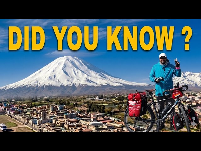
Hello, Namaskar, Salaam, Sat Sri Akal, and Ram Ram Ji!
Once again, welcome to my channel. On my Pole-to-Pole World Cycling Journey, I am currently in Peru. In front of me, you can see three beautiful mountains. These are volcanic mountains. One is over there, and the other two are on that side. The city we are heading to today is surrounded by these volcanic mountains, and from there, you get stunning views of them.
Today’s ride is around 75 kilometres.
This was the hostel where I stayed last night. It was built near a toll plaza. I decided to stop here because yesterday the winds were incredibly strong. Cycling against them was almost impossible. For the last 3–4 kilometres, I had to push Dhanu (my bicycle) all the way.
There is a rule in this region: after around 11 a.m. or noon, strong winds suddenly begin and continue until about 5 or 6 p.m. After sunset, they gradually calm down.
It is now 8:30 a.m., and over the next four and a half hours I will try to cover as much distance as possible. There is a small climb of about 200–300 metres ahead, but after that there is a descent of nearly 2,000 metres.
At the moment, we are at an elevation of 4,100 metres above sea level, and we will descend to around 2,400 metres. That means nearly 2,000 metres of elevation loss.
Look, there are llamas roaming around here as well.
Come on, Dhanu. Let’s begin in the name of God and get the job done.
In this region there are thousands of llamas and alpacas. They look tiny from a distance, so the camera cannot capture them properly, but I can see them clearly with my eyes. Some are even standing beside the road.
This area is basically a national park, and we are riding right through it.
Yesterday I showed you the three volcanic mountains from a distance. Now they look completely different. The mountain with two peaks is over there. This one is Misti, and that one is Pichu Pichu. There are three major mountains here.
I will try flying my drone to get a better view from above. I have heard that trekking is also popular here, especially around Misti Volcano. Fortunately, it is not currently active. However, there are active volcanoes in this region, and earthquakes are quite common.
The city of Arequipa lies on the other side of these mountains. To reach it, we have to ride about 75 kilometres. In a straight line, it is only around 20–25 kilometres away, but the road loops around before reaching the city.
Let’s fly the drone and see what we can capture.
There are many llamas around here. I would love to go closer, but entry into that area is prohibited because it is part of the national park. They probably come to the lagoon to drink water.
Right now, we are still at 4,100 metres. Soon we will say goodbye to this land of llamas because a massive descent awaits us. We have nearly 2,084 metres of descent ahead over the next 68 kilometres.
We have spent almost one and a half to two months at these high altitudes. It has been challenging at times, but also rewarding. We gained a lot of experiences and learned many lessons.
Now a completely new experience awaits us. The landscape will soon start looking like the Atacama region again. We will ride through Atacama for another hundred kilometres or so and then head towards Lima. We should be able to move quite quickly.
Nazca lies ahead as well, so I will show you that when we get there.
The railway line is still running alongside us. This is the old track; the new railway line has been built further away.
And there it is—the mountain I was talking about earlier, Pichu Pichu. We have come very close to it now.
Below us is a huge valley. We have climbed all the way from down there. Time to enjoy the descent!
The winds started as early as 10:30 today, and there is also quite a bit of traffic, so the ride is not as enjoyable as it could be. But just look at the scenery ahead—it is absolutely stunning.
Here comes a convoy of trucks. This convoy only has three trucks, though perhaps some are further behind.
Look at those snow-capped mountains appearing again in front of us. What an incredible sight!
Just look at this view. The valley drops away below us, and in only 13 kilometres we have already descended 500 metres without even realising it.
The sky on this side is completely clear. Soon we will enter the Atacama region. There is a huge amount of dust in the atmosphere there. That dust can be quite harsh; it can even cause nosebleeds.
Still, we will have to spend another five to ten days in the Atacama region.
Wow! What a breathtaking view.
Come on, Dhanu! Keep going!
These mountains look magnificent. If this were an uphill climb, I would probably be crying. But since it is downhill, I am happily singing. Human beings can be very selfish sometimes!
The scenery has completely changed. Earlier I was on the side of the snow-covered mountains; now I am on the other side.
What an amazing valley! For the first time in a while, I can see flowers and plants again. There is even a pleasant fragrance in the air.
Notice how there was no dust at all on the other side of the mountains. Here, however, the entire region is covered with dust.
These are the Andes Mountains. They act as a barrier, preventing the dust from the Atacama Desert from reaching the other side. Beyond the Andes, around 1,000 to 2,000 kilometres further east, lies the Amazon region.
Because of the Andes, the Amazon remains protected from the Atacama Desert. Nature has such an incredible way of balancing everything.
Look at all the cacti appearing now. We are definitely entering the desert landscape.
As we continue descending, Arequipa is still about 45 kilometres away.
The view is unbelievable. There is even a small village down in the valley. Somewhere over there is where we came from.
Look at the trucks struggling on these steep roads.
We have now descended much lower into the mountains. The landscape is starting to look greener, although it is still quite dry. This is clearly the Atacama Desert region.
Over there you can see a large cement factory.
After nearly three days, we have finally come across what looks like a town. Its name is Yura.
Arequipa is now only 25 kilometres away. Yet another mountain range appears ahead. I am not sure which range it is. There is a valley in between, and on one side lies the dry desert landscape.
The city is located on the far side of the valley. Once we go around this section, we will enter the city.
Look ahead—the city sits right in the valley. It looks quite large from here.
“Hello.”
“Hello.”
“So this is his wife. How are you both?”
“How many years have you been here, brother?”
“I’ve been living here for about eight years.”
“Oh, really? And how long have you been married?”
“We’ve been married for around five years now.”
“Five years! Congratulations to both of you.”
“Thank you so much.”
“We also have a three-year-old daughter.”
“That’s wonderful! Was she born here as well?”
“Yes, she was born here.”
“And what’s her name?”
“We named her Aaliya.”
“Aaliya?”
“Yes. We wanted a short name that people here could pronounce easily, so we chose Aaliya.”
“Thank you, thank you.”
Back in the 1800s, when Peru’s independence movement began, it actually started from this city. Because of that, the people here believe their city played a major role in Peru gaining independence.
Many locals even symbolically consider Arequipa to be a separate nation. They proudly say that they are from Arequipa first and Peru second. They have even created their own symbolic passport and stamp it as a local tradition.
Now let’s head towards the city centre. There are some amazing facts about this city that I want to share with you.
In the previous video, you saw the three volcanic mountains surrounding this region. Arequipa is nestled right in their embrace.
Because of these volcanoes, earthquakes were very common here. The residents faced constant challenges, as ordinary stone buildings were often damaged.
The Spanish settlers made an important discovery. They found that volcanic ash and lava deposits eventually hardened into a special type of stone. This stone was lightweight, strong, and much safer during earthquakes. It is called “sillar.”
The entire city is built using this white volcanic stone. That’s why most of the buildings appear bright white.
Look at this building. It was probably constructed around the 1820s or 1830s. This is a very old city.
Now let’s continue towards the city centre.
Most of these buildings are original. Some have been painted, but special permission is usually required because excessive colours are not generally allowed in the historic district.
Because of the white volcanic stone, Arequipa is often called “The White City.”
Locally, it is known as “La Ciudad Blanca” — the White City.
Look closely. These structures are all made from white sillar stone, which comes from volcanic deposits.
The building in front was probably built later, perhaps in the early 1900s, as its architectural style is more modern.
We’ve now entered the central street of the city. This is where people gather, stroll around, and shop. Most of the large showrooms and commercial establishments are located here.
Even cyclists are riding through the area.
Ahead, you can see a famous gateway. It is one of the city’s well-known landmarks.
Arequipa is Peru’s second-largest city after Lima. The population is around one to 1.2 million people, making it the largest city in southern Peru.
Lima is located more centrally, while further north towards Ecuador there are other major cities as well.
As we continue our journey towards Ecuador, I’ll show you those cities too, along with several other important tourist destinations.
For now, though, we are exploring Arequipa before moving on.
I need to reach Lima quickly because I have applied for a Canadian visa, and my appointment date is approaching.
From here, I’ll try to cover around 150 kilometres per day and reach Lima within the next five or six days.
The route ahead will take me through Nazca. Nazca is around 400–450 kilometres away, and Lima is another 450 kilometres beyond that.
Look at this main gate.
The sunlight here is extremely strong throughout the year. Although the weather remains relatively cool, the sun feels intense.
The temperature usually stays between 20 and 25 degrees Celsius because the city sits at an elevation of around 2,400 metres above sea level.
And here we are — the beautiful city centre.
The historic centre of Arequipa is also recognised as a World Heritage Site.
As I mentioned earlier, the people here have a strong regional identity. Most residents proudly identify themselves as Arequipeños before calling themselves Peruvians.
This is the main square.
Spanish settlers first arrived here around 1540. The surrounding region was rich in silver and copper mines.
Because the higher elevations were difficult to live in, the Spanish chose Arequipa as their base camp. At 2,400 metres above sea level, the climate was ideal — neither too hot nor too cold.
So they established their administrative centre here.
The square reminds me a lot of Connaught Place in Delhi. Shops surround the entire plaza, and many of them have upper floors as well.
The indigenous tribes originally lived in this area. Between the 1500s and 1800s, large numbers of people were gradually converted to Catholicism.
Today, Catholicism is deeply rooted in the city’s culture.
In fact, Arequipa is sometimes referred to as the “Rome of South America” because of its many churches.
There is even a church where the Vatican flag is flown.
You could almost describe Arequipa as South America’s version of Rome or a miniature Vatican City.
The city is incredibly beautiful.
Just look at the view from here.
And over there you can see another church, which we’ll visit shortly.
Before that, let’s find a good viewpoint where I can fly the drone and show you a bird’s-eye view while sharing more of the city’s history.
Now take a look at these sillar stones.
When a volcano erupts, ash spreads across the landscape. Over time, the ash compresses and hardens into stone. That’s exactly how these stones were formed.
Earlier I mentioned the large number of musical instrument shops in the city.
It’s remarkable — every third or fourth shop seems to sell musical instruments. I don’t know if the people here are really that passionate about music, but there are certainly plenty of music stores.
The building in front of us dates back to 1895.
There are underground sections beneath it as well.
And now we’ve reached the river.
Let’s walk along it for a while.
I decided to stop and eat some watermelon.
The watermelon here is delicious — incredibly sweet.
I asked a lady vendor to cut me a few slices.
And here we are.
Look over there. That’s Misti Volcano.
And this is the river.
It’s called the Chili River. I’m not entirely sure why it’s called the Chili River, but that’s its name.
I’m thinking of flying the drone again from here.
The three volcanoes standing together in the background look spectacular, especially with the church positioned between them.
Below flows the river, and all around is a city of more than a million people.
Despite being so clean and tourist-friendly, Arequipa isn’t as internationally famous as places like Cusco or Puno.
The streets throughout the city are paved with stone, yet everything is remarkably clean and well maintained.
We’ve now crossed into another part of the city, which isn’t quite as old as the historic centre.
One thing I’ve noticed is that kulfi is extremely popular here.
Street vendors sell it just like they do in India.
The old towns built centuries ago are incredibly beautiful.
Although colonial powers exploited local people, the structures they built were undeniably impressive in terms of craftsmanship and quality.
Labour was essentially forced, and workers carried stones from distant locations before constructing these buildings.
The rulers simply gave orders while others did the hard work.
The circumstances may have been harsh at the time, but today we admire the beauty of what remains.
Look at this place.
What a sight!
This appears to be a restaurant.
I’ve now wandered towards another bridge.
Actually, yesterday I saw a painting here that left a deep impression on me. It was so meaningful that I returned specifically to see it again.
Here it is.
Look carefully.
There is a fruit pierced by an arrow.
There is a child, and the child’s mind is represented separately.
Inside the child is a small bird.
What a meaningful piece of artwork.
I came all the way back here just to see this painting again.
Look, there’s a Mahindra pickup truck parked over there.
And behind it, you can see the mountains.
We’ve now reached another bridge.
Underneath this bridge is a beautiful five-star hotel.
And once again, here are kulfi vendors selling their products.
Kulfi is surprisingly common in this city.
Winter is about to begin here.
Listen to the bus driver calling out destinations from inside the bus:
“Come on, get in! Come on, come on, come on!”
Look at this house.
It was built in 1862.
The original iron railings and decorative metalwork are still intact.
This is another major monastery and church complex.
Everything is contained within its walls.
Wow!
You could almost call it an old fortress.
Visitors can purchase tickets and explore the interior.
Do you know how much the ticket costs?
Fifty Soles!
That’s roughly ₹1,300 to ₹1,500.
This is Santa Catalina.
The famous cathedral and monastery complex is located inside.
It’s called the Monastery of Santa Catalina.
I already showed it to you from the drone earlier, but let me show it once again.